
Transportation

The Importance of Transportation
TRANSPORTATION is very important in almost every part of our daily lives. Without transportation, we could not travel around. We would have no products to buy in stores. We could not get items delivered to our homes.
AGRICULTURE is also an important part of our daily lives. We rely on agriculture to give us food, clothing, and fuel for our vehicles every day. Farmers rely on transportation to get the food they produce to the people who need it. Can you imagine not having a way to transport food, clothes, or other items that you need in your life? How could we survive without transportation?
Illinois is located at the center of the transportation system in the United States. Our state produces food that feeds people around the world. Our state is home to the largest railway junction in the nation. Our river system allows massive amounts of products to be shipped out of the country. Our advanced network of roads and interstate highways connects us to the rest of the country.
We are lucky to have an amazing transportation system in Illinois. We also have thousands of people with CAREERS in transportation who help get people, goods, and services where they need to be. Let’s learn more about the roads, rivers, and rails that connect us all and help agriculture remain the #1 industry in Illinois.
Illinois: A State Shaped by Glaciers
The movement of goods on our roads in Illinois is fast and easy, partly because most of our state is very flat. Illinois was not always like this. Our state’s land looks like it does because of glaciers.
The first GLACIER made its way into Illinois about 300,000 years ago. The fourth and final glacier melted slowly about 13,000 years ago. The glaciers left behind flattened land and rich, healthy soils which Illinois farmers now grow their crops in.
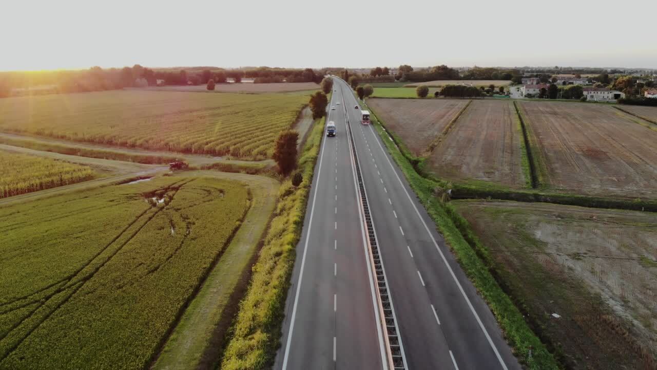
Roads
Today, farmers use 75% of our state’s land for agriculture. All parts of our state are connected by a vast system of roads. We use roads every day. We use them to travel to school, work, and businesses.
Delivery services and the post office also rely on roads to get our mail, packages, and other items delivered to our front doors. Without roads, none of this would be possible. Illinois is also home to more than 34,500 miles of state highways. There are thousands of miles of other roads that connect every part of our state.
Drivers use these roads every day to travel and transport goods where they need to be. Farmers use these roads to move their farm vehicles and haul their crops to store them or sell them. Many people work in careers to build, repair, and take care of our roads.
Rivers
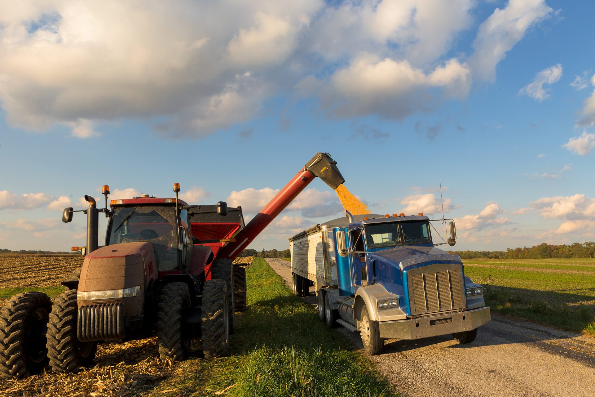
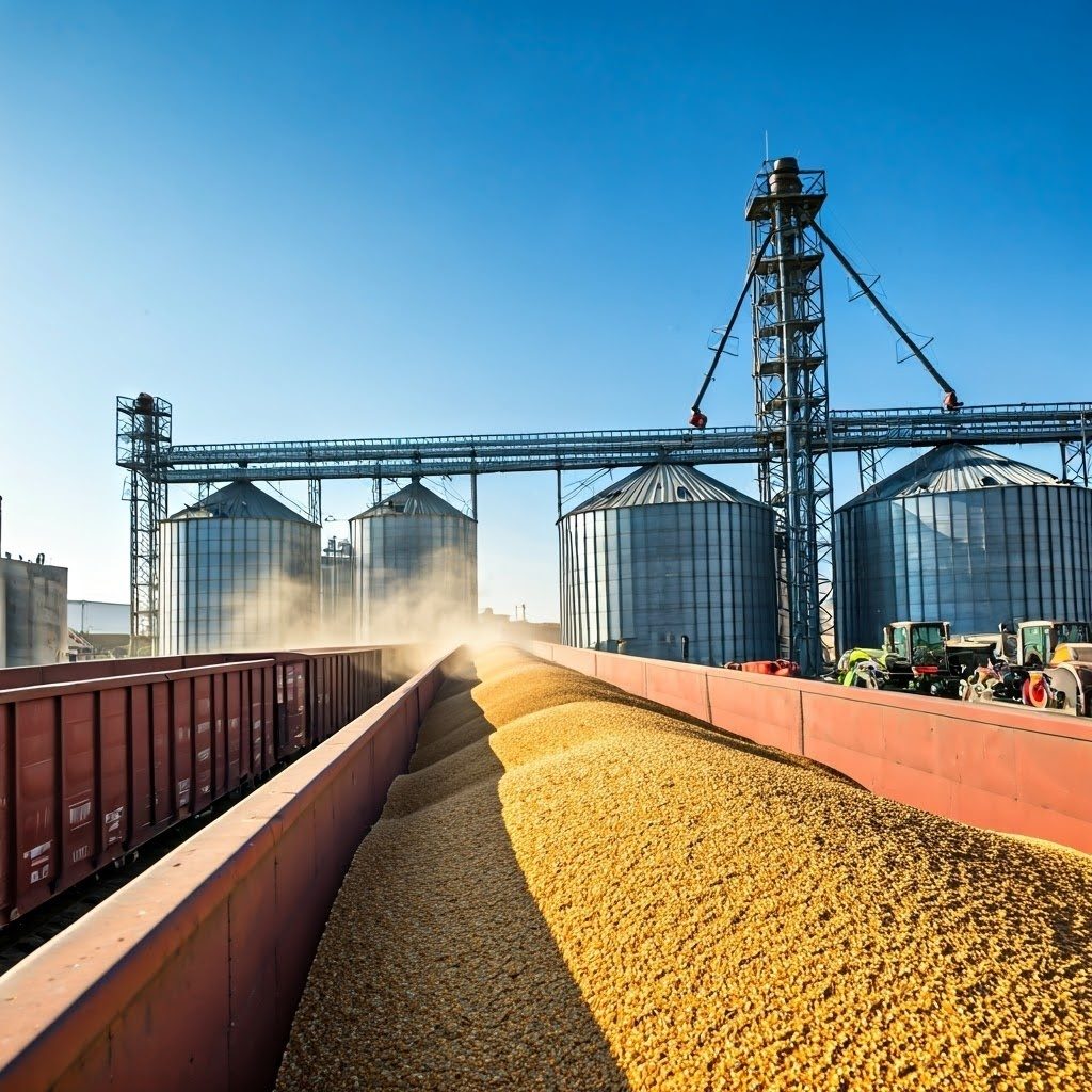
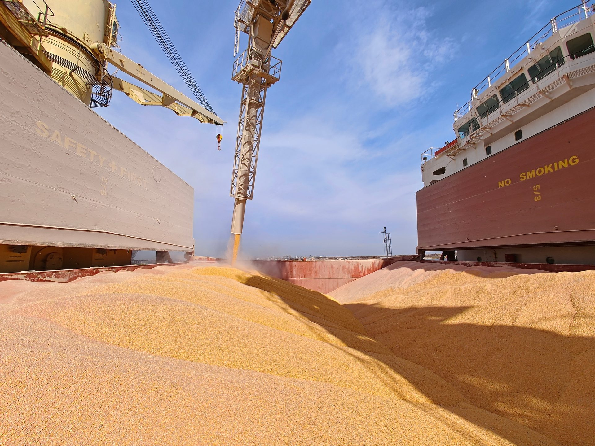
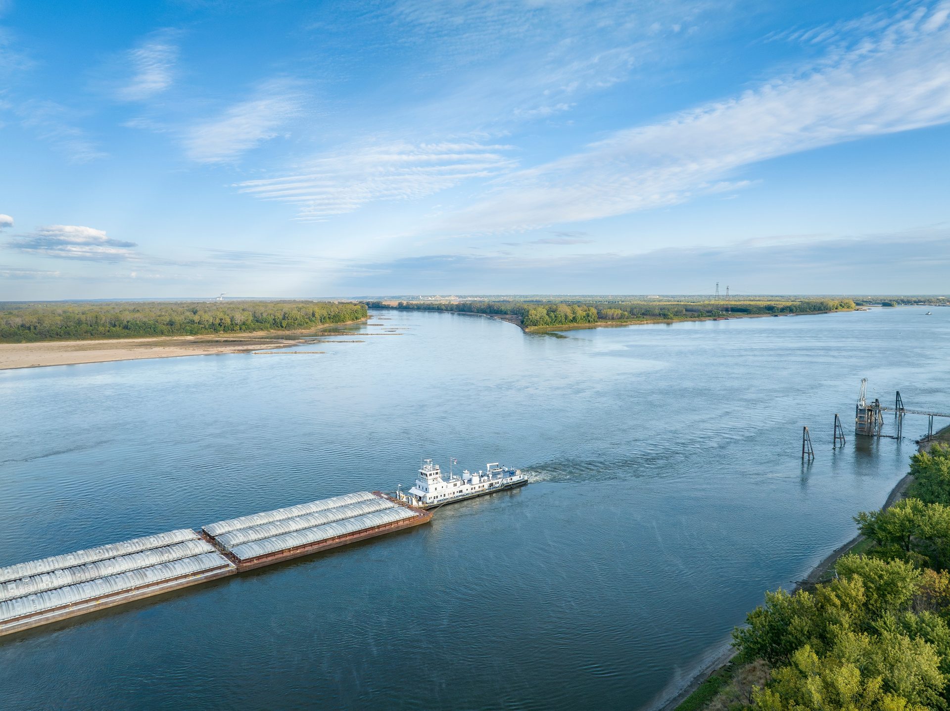
Many rivers in Illinois are important for transporting goods. The Mississippi, Illinois, and Kaskaskia Rivers in Illinois contain more than 1,100 miles of waterways that allow large boats to travel. Barges move massive amounts of agricultural products in and out of the state.
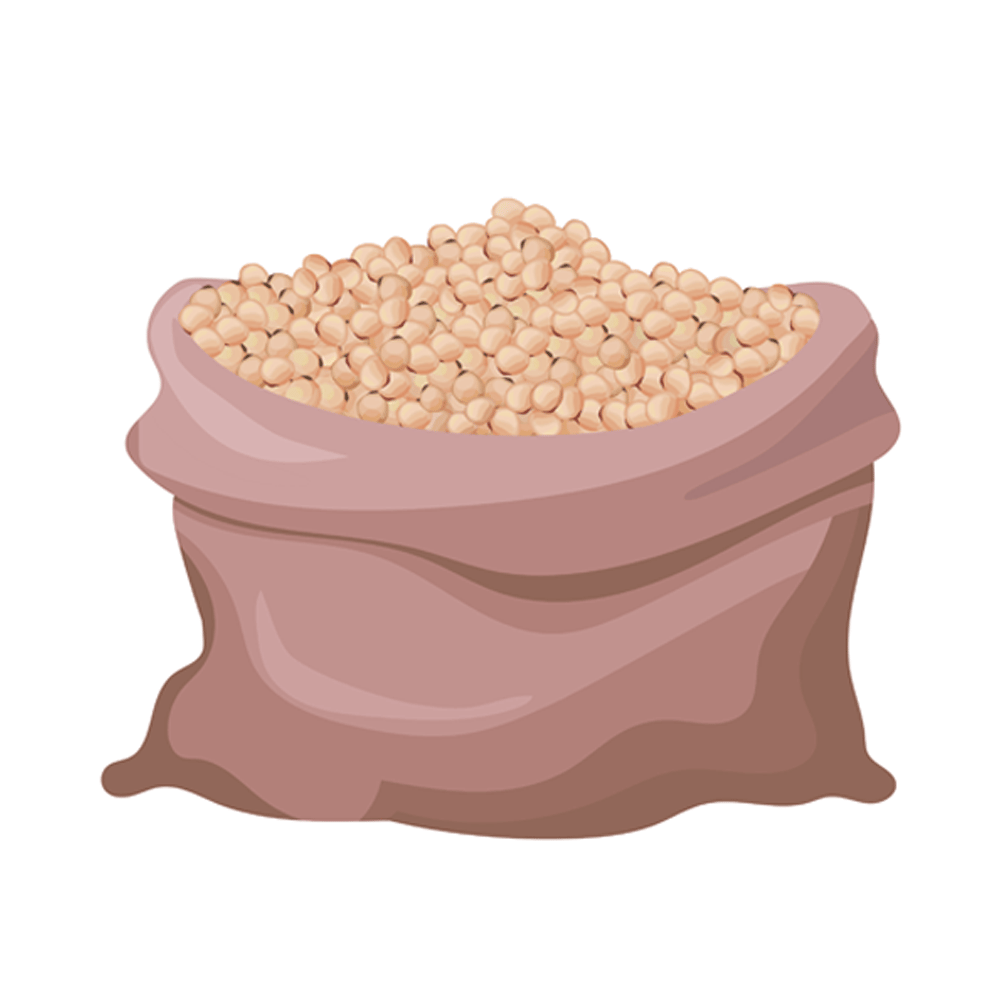
Corn and soybeans grown in Illinois are often transported on barges. We don’t use all the grain we grow in our state. Some of the grain grown on Illinois farms is loaded onto barges and shipped to other states and countries as an EXPORT. A full barge can haul the same amount of grain as over 500 semi trucks. Barges also use less fuel than trucks or trains. One gallon of fuel is all that is needed to haul one ton (2,000 lbs.) of goods 600 miles on the river.
Understanding the Lock and Dam System
A river BARGE is a huge boat that requires wide, deep rivers to travel safely. The rivers in Illinois were not originally good for river transportation. Over time, the rivers were widened and deepened by humans. Then, large boats could pass more safely. Also, a system of locks and dams was built to help these big boats travel better on difficult sections of the river. A LOCK and DAM work together to form a contained area that a barge can be driven into. Then, the water level is raised or lowered before the boat is released through the other end. Just like an elevator raises and lowers people through tall buildings, a lock and dam is like a water elevator for boats!
There are 37 locks and dams in Illinois. It is very important that our state’s lock and dam system is well-maintained. We rely on the locks and dams to transport many agricultural products out of our state.
How a lock and dam
system works
Floating to the Past: The Amazing I&M Canal
The I & M CANAL might be one of the best-kept secrets in American history. Today, Illinois has more people who live here than any other inland state. Chicago, IL is the 3rd most populous city in the country. The I & M Canal is directly connected to why so many people live in our state today.
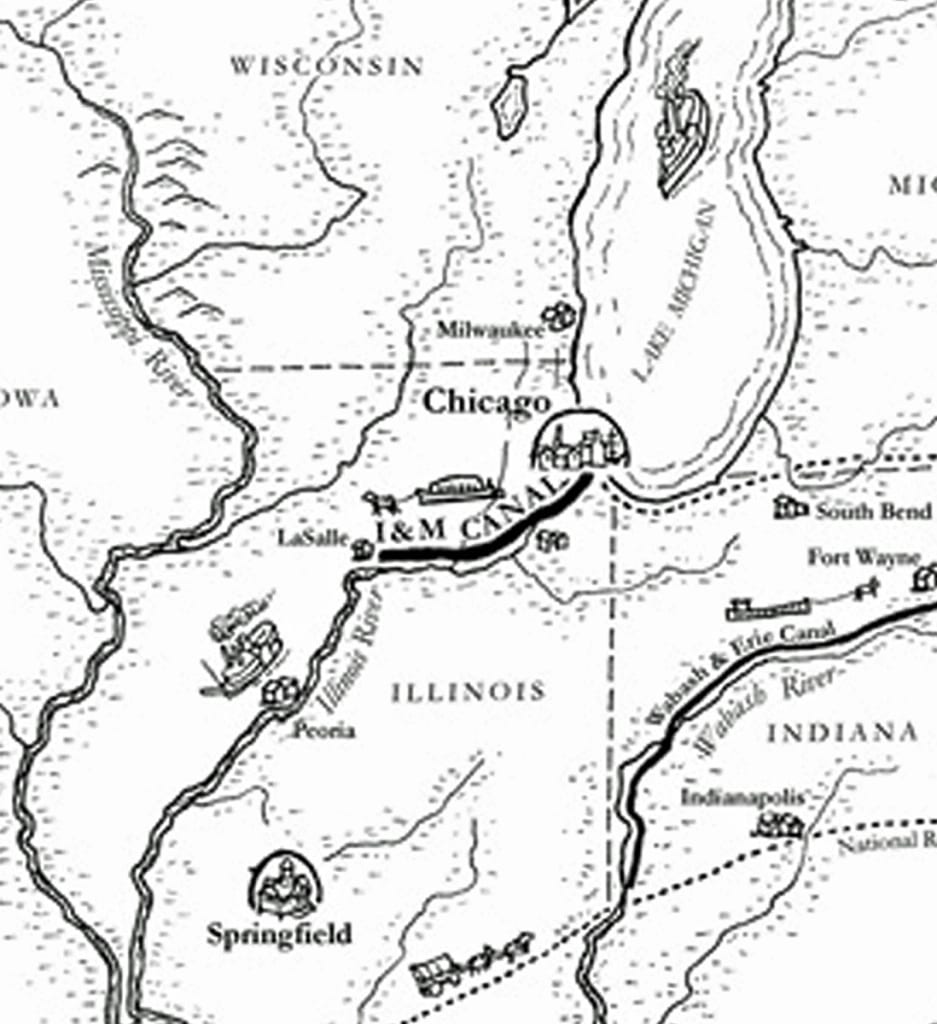
The I & M Canal is a 96-mile-long canal that was completely dug by hand. The canal was started in 1836 and finished in 1848. The canal connected the waters of Lake Michigan with the Illinois River. Then, people in the United States could travel on water all the way from the Atlantic Ocean on the East Coast of the country, through the Great Lakes, and down the Mississippi River to New Orleans.
The canal greatly improved transportation at the time. Distant parts of the country were suddenly more connected. New people, new products, and new ideas could more easily come to Illinois and the surrounding lands. The I & M Canal remained open for boat traffic for 85 years. It had a big impact on the city of Chicago and the future of the state of Illinois.
I&M photos Courtesy of Lewis University
Career Profile
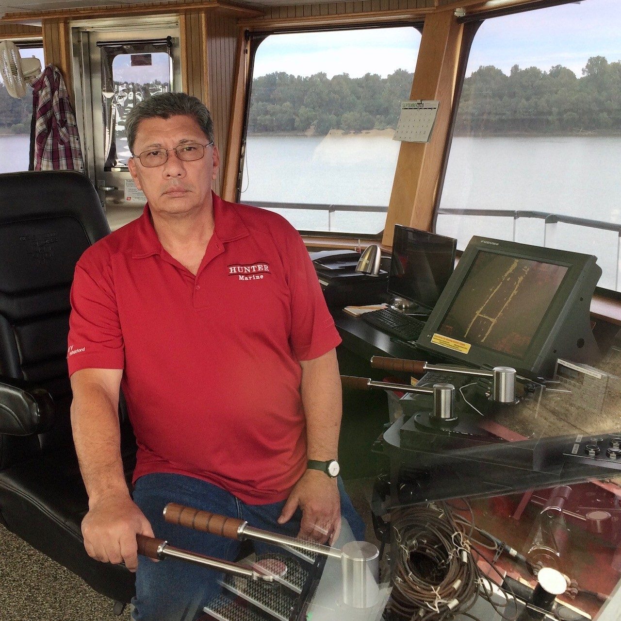
Ray Bennett,
Towboat Vessel Captain
Ray is the captain of a towboat that pulls 15 barges at a time down the Cumberland River. For each journey, he starts in Cairo, Illinois and ends in Nashville, Tennessee. Ray’s barges haul fertilizer, steel, and ethanol products made from Illinois corn.
Ray says, “I really enjoy just driving the boat down the river. It’s a challenge to safely navigate each situation with the constant changes in water levels and weather conditions. My job requires me to be away from home four weeks at a time, which is really hard. The best part is getting to go home for my four weeks off to spend time with my family!”
Transportation jobs like Ray’s are important to making sure we have all the goods we need for our daily lives.
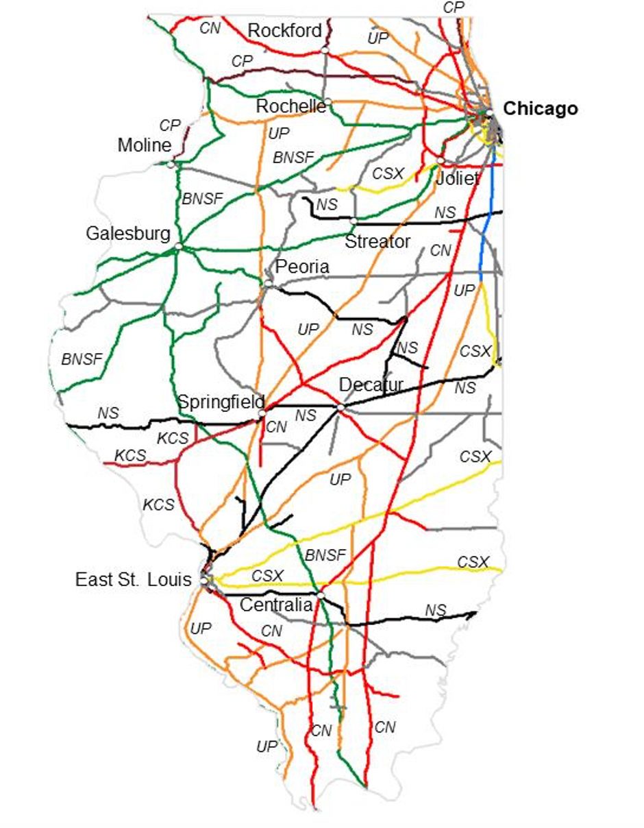
Rails
Railroads have also played an important role in our state’s history. Before 1840 there were hardly any railroads in Illinois. Forty years later there were 8,000 miles of railroad in Illinois! Railroads created jobs for people in Illinois. Railroads made it easier to transport goods and people in the state. This led to creating even more jobs and many new businesses. People then needed a place to live, so new communities formed along the railroad tracks. Eventually, over 12,000 miles of railroad tracks were built.
Today, there are over 7,000 miles of railroad tracks still in use in Illinois. Our state still has more miles of railroad tracks than every other state except Texas. Chicago is the home of the largest RAILWAY JUNCTION in the country. Over 1,300 trains pass through the Chicago area every single day.
Trains and Agriculture
Many trains in Illinois haul corn, soybeans, livestock, and many other agricultural products. One train can haul the same amount as hundreds of trucks. And trains can move one ton of cargo 500 miles on only one gallon of fuel.
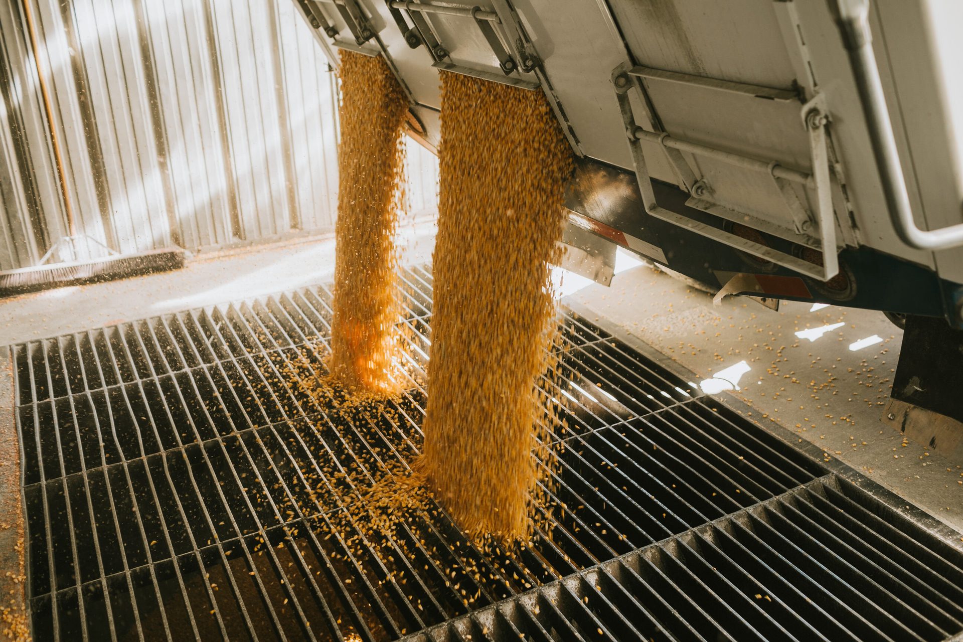
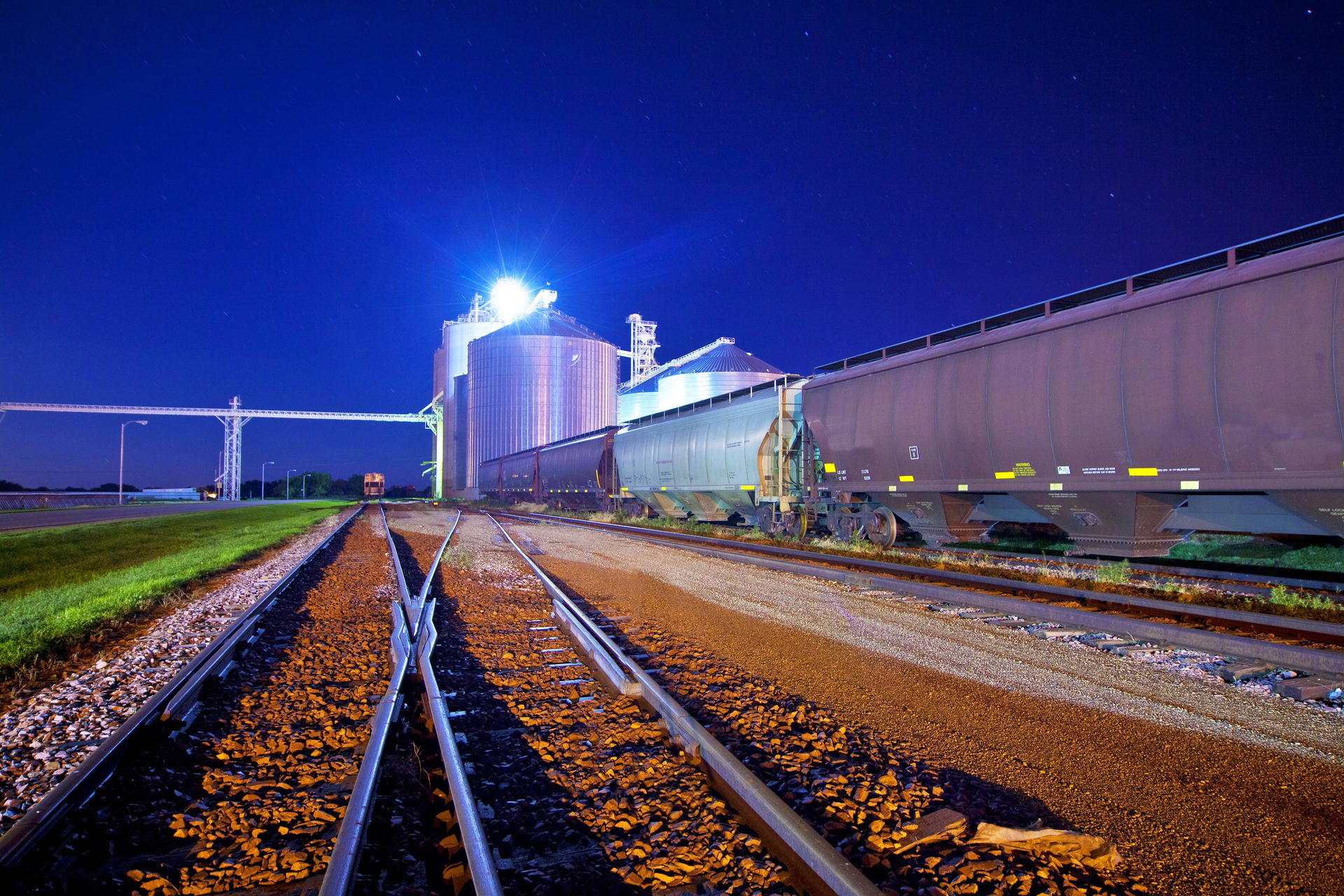
Crops are often loaded onto trains from a GRAIN ELEVATOR. Farmers can sell their crops to a grain elevator once they are harvested. The grain elevator dries and stores the crops until they are ready to sell them. When it is time to sell the grain, it is released from storage bins into empty train cars. Then the trains haul the grain to other locations to be made into animal feed, ethanol, biodiesel, and thousands of other products that we use every day.
McLean's Storage Container: An Amazing Invention!
Malcom McLean once owned the largest trucking company in the United States. He was tired of seeing how difficult and slow it was to load and unload cargo from his trucks to a train or ship. He wanted to create a way to make INTERMODAL TRANSPORTATION more efficient. In 1956, he invented the first standard shipping container. This simple invention made transporting goods safer, faster, and easier. Today, around 90% of the world’s goods are transported in shipping containers. Containers today are made to transport all sorts of goods. Some containers are even refrigerated to keep food and other items fresh as they are being transported. It’s possible that many of the items in your classroom and your home were once on a shipping container!
DID YOU KNOW
of the trains that haul corn to Mexico from the U.S. start right here in Illinois.
40%

A 110-car train can carry up to
403,000
84 billion
bushels of soybeans.
soybeans!
of the corn grown in Illinois is exported to other states and countries.
48%

HOW FAR CAN IT GO?
If we are hauling 1 ton (2,000 pounds) of corn from an Illinois farm using only one gallon of gas, how far can we get on our roads, rivers, and rails?
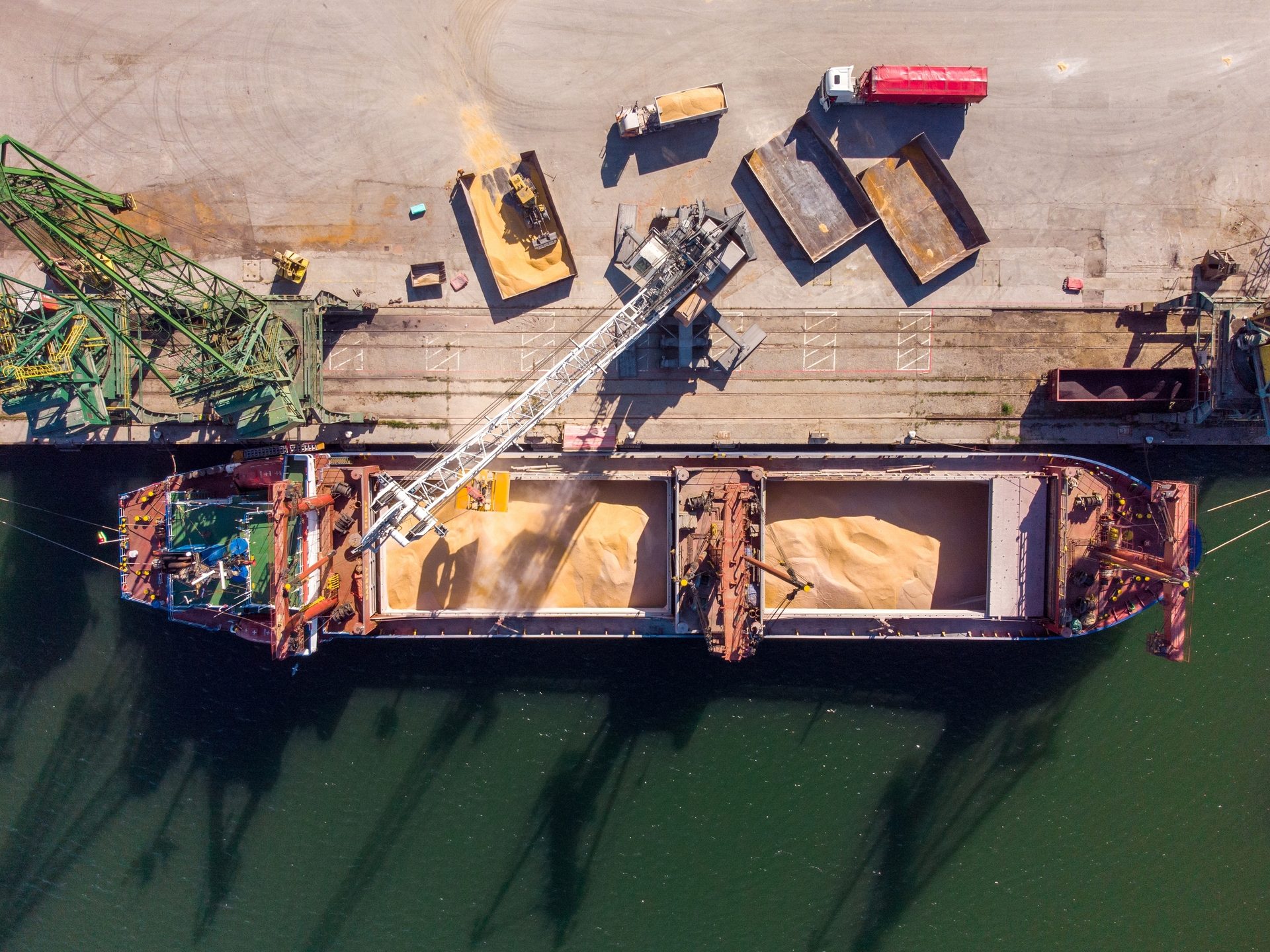
The Long Path to Market
These photos show one way corn grown in Illinois is exported to other countries.
1.
Corn leaves the farm on a semi truck.
2.
The semi truck empties the corn at a grain elevator.
3.
The grain elevator loads the corn into a train car.
4.
.
The train unloads the corn at a new grain elevator.
5.
The corn is loaded onto a barge on the Mississippi.
6.
The barge arrives in New Orleans.
7.
The corn is loaded onto an ocean ship that sails to another country.
Route 66
Celebrating 100 years of "America's Main Street"
Route 66 is one of the most famous roads in the entire world. The popular road began in 1926 and existed until 1985 when it was replaced by bigger, faster interstate highways. The original road was 2,448 miles long. It started in Chicago, Illinois and headed west through six states before ending in Santa Monica, California. Illinois was the first state to have its entire portion of Route 66 paved.
Today, there are groups across the country who are working to maintain parts of the original road and educate people about how special it is. In 2026, people across the nation will celebrate the 100th anniversary of “the Mother Road.” This will be a great time to take a road trip and learn more about fun roadside spots in our great state!
Route 66 changed our country. It made travel between the central and western parts of the nation easier than ever before. It also became an important route for trucks to haul goods. Many of these goods included agricultural products. Along the road, communities, restaurants, and other businesses sprang up to provide for all the people traveling along the route. Route 66 was a symbol of American freedom and the pursuit of the American Dream. Today it is still an important American icon. And it all started right here in Illinois!
Route 66: Before the Famous Road
The path of Route 66 in Illinois was important for transportation well before the invention of the automobile. It was once a footpath called the Pontiac Trail used by Native Americans for thousands of years. In the 1830s, Native Americans were forced from their homes in Illinois. Settlers in the state eventually made parts of the Pontiac Trail a dirt stagecoach path between Springfield and St. Louis. Later it became a paved road. Eventually, Route 66 was built on the same site.
During the Dust Bowl in the 1930s, thousands of families left the Midwest. Many of these were farm families who could no longer support themselves when crops wouldn’t grow on their farms. These desperate families used Route 66 to travel across the country to California in the hopes of finding new jobs. Years later, during World War II, Route 66 was an important path to transporting military equipment across the country.
The Route Today
Technically, Route 66 stopped being an official road in 1985. The route is known by different names and numbers today, but we can still enjoy the legendary road in Illinois. Today, Historic Route 66 signs line many parts of the original road. These signs are a reminder to travelers of the important history of Route 66. Many sections of the road and important roadside locations are registered on the National Register of Historic Places. Route 66 might be gone, but its legend lives on in places all across Illinois!
You "Auto" Know
"Get your kicks on Route 66" is a well-known saying, even today. This expression originally appeared in a song written by jazz musician Bobby Troup in 1946. Troup actually wrote most of the song while traveling along Route 66! That same year, Nat King Cole recorded a version of the song which became a big hit. Since then, many musicians have recorded unique versions of the song. One of the most recent versions of the song appeared in a 2006 movie you might know: the Disney/Pixar movie Cars.
POPULAR NICKNAMES FOR ROUTE 66
The Mother Road
America's Main Street
The Will Rogers Highway
The Road of Dreams
This issue of AG MAG has been provided by:
This Ag Mag complements and can be connected to the following standards: Common Core State Standards: ELA-Literacy.RI.4.1; RI.4.2; RI.4.4; RI.4.7; RI.4.10; W.4.1.B, Illinois Social Science Standards: SS.4.EC.2; SS.4.6.2; SS.4.6.3; SS.4.H.3, Next Generation Science Standards: 4-ESS1-1; 4-ESS3-1.